| The El Niño phenomenon centers on the Galapagos Islands in the eastern tropical Pacific Ocean. It is a common phenomenon in this area of the world occurring unpredictably every three to ten years. |
Galapagos is located in the equatorial Pacific Ocean. (NOAA image edited by GA)
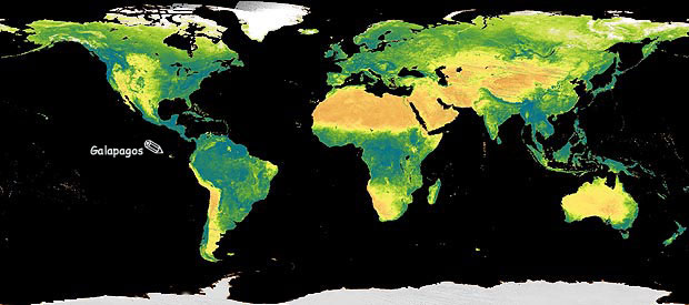
| Found 600 miles west of Ecuador in South America, the Galapagos Islands straddle the equator. Notice that they are almost directly below New Orleans in the United States. |
Galapagos is a group of islands. (Image, with permission, from Robert Rothman)
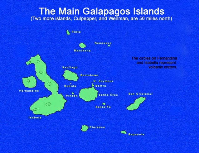
| Formally called the Archipelago de Colon, these islands commonly retain their name Galapagos (which means tortoise). The island group consists of 12 major islands, many small islands and several rocks. There are few settlements in the Galapagos and most islands are uninhabited. They are owned by Ecuador and have become a preserve. The Ecuadorian National Park Service limits the number of visitors each year to the Galapagos and has specific designated landing spots and trails on each Island for visitors. A trained guide must also accompany all visitors while on the islands. This affords a large measure of environmental protection to the islands. |
| The largest island is about 70 miles long. Most islands are about 20 miles apart (about as far as it is from Santa Barbara to the Northern Channel Islands). |
Galapagos Shield Volcano. (Halbach image)
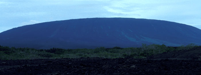
| Made almost entirely of volcanic rocks, Galapagos still has some active volcanoes in the western area. These volcanoes are 'shield' volcanoes with gently sloping sides. They are also considered to be 'gentle' volcanoes and lack the destructive explosive forces of the more steeply sided volcanoes of the world. Most of the central and eastern islands are uplifted undersea lava extrusions without volcanic craters. |
Major ocean currents on Earth circulate clockwise in the northern hemisphere and counterclockwise in the southern hemisphere. (NOAA image edited by LJF and GA)
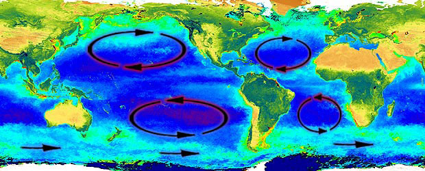
| Westerly flowing tropical water is the norm in the Pacific and Atlantic Oceans. It is moved by the strong westerly blowing Trade Winds. This force creates a difference in sea level of over five feet from the eastern to the western side of the Pacific Ocean (the western side is higher near Australia). Water veers right in the Northern Hemisphere and left in the Southern Hemisphere due to the Coriolis force. This creates the major oceanic currents that rotate clockwise in the Northern Hemisphere and counterclockwise in the Southern Hemisphere. |
| Galapagos is in the path of a cold current (the Peru or Humboldt Current), coming from Antarctica, up the coast of South America. It is also in an area that has significant seasonal upwelling. Upwelling brings deep, nutrient rich, bottom water to the surface, which enhances marine productivity. |
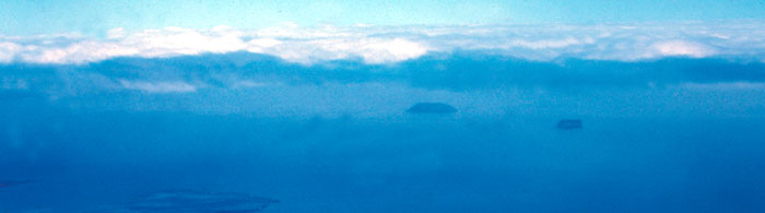
The tops of the Galapagos Islands show through the dense cloud cover during an El Niño. (SA image)
| The cessation of the Trade Winds in the area surrounding Galapagos happens unpredictably every three to ten years. Without the Trades, the tropical waters sit still, warming up until a distinct thermocline sets up. The thermocline locks nutrients out of the surface waters. It is this condition that was named 'El Niño' because it generally begins around December. 'El Niño' means 'the male child' that is used for the 'Christ Child.' In most El Niño years this condition lasts a few months, centered on Galapagos with little global effect. |
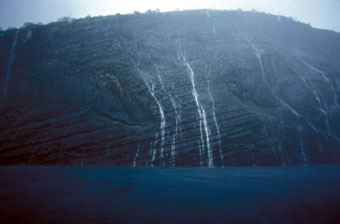
The Galapagos Islands are usually very dry and desert-like (Halbach image left) but during El Niños the rainfall may increase so much that the islands can not absorb the water and it runs off the islands (SA image right).
| El Niño increases the rainfall in Galapagos as the still air gathers moisture from the warming ocean. The longer the El Niño continues the greater the increase in the rainfall and the warmer the ocean water becomes. During normal El Niños, the few months without the Trades cause small changes to the annual average rainfall and ocean temperature. As soon as the Trades begin to blow, the normal ocean currents return and any clouds are blown across the Pacific to the west, the ocean returns to its cold temperature and upwelling brings nutrients to the surface. |
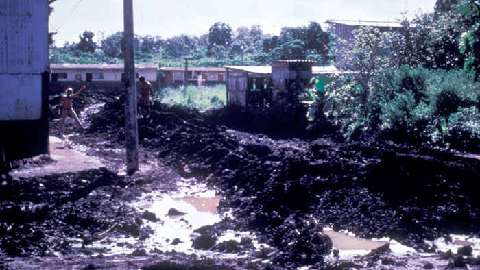
The flooded streets of Bella Vista in Galapagos during the '82/'83 El Niño. (Image, with permission, from Gary Robinson)
| Extreme El Niños cause catastrophic changes in the environment. The first really extreme El Niño in recorded history was in the '82/'83 year where the El Niño condition lasted over a year. The normally 60 degree Fahrenheit ocean water increased up to 90 degrees in some areas of the Galapagos. The normal rainfall in some areas was close to six inches per year but in '82/'83 it was up to twenty times this, 120 inches in some areas! |
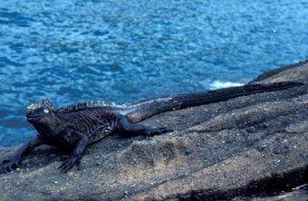
Galapagos shorelines generally have a great deal of marine algae at low tide (Halbach image left) but this is all gone during severe El Niños when a Kelvin Wave increases sea level (SA image right).
| Sea level changes in extreme El Niño years. This is because the normal energy from the Trade Winds, blowing across the Pacific Ocean (piling up water on the western side near Australia over five feet higher than near Ecuador) fails. If this is just for a few months there is little global change but in extreme (long) El Niños, the bulge of water near Australia (that may be over five feet) actually sloshes back across the Pacific Ocean in the opposite direction to the normal current. This is called a Kelvin Wave and when it reaches Galapagos the normal sea level can rise over five feet causing changes for both the human residents and the marine organisms. |
|